Site Contents
Home
Salmon Fishing Scotland
Salmon - Where to Fish
Salmon Fishing Tackle
Salmon Fishing Tactics
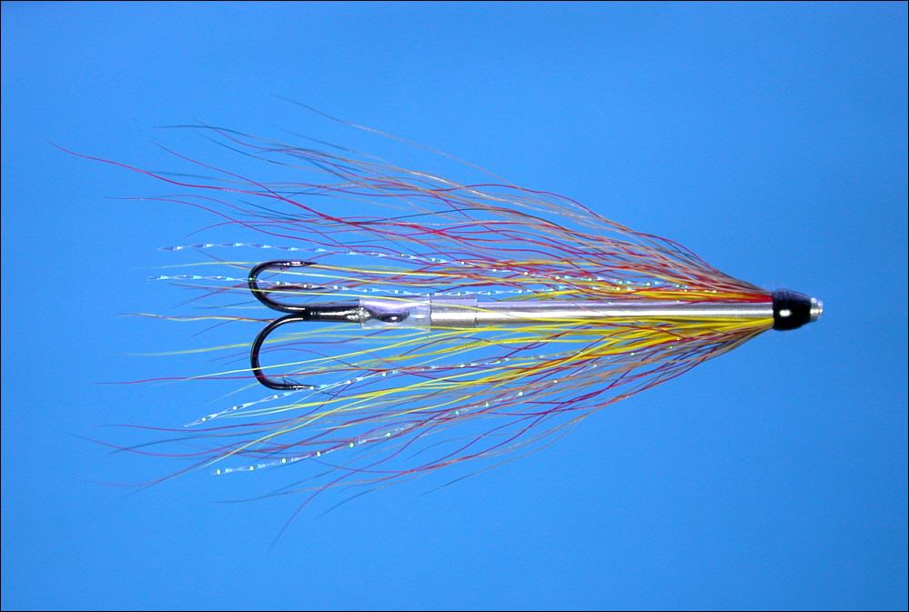
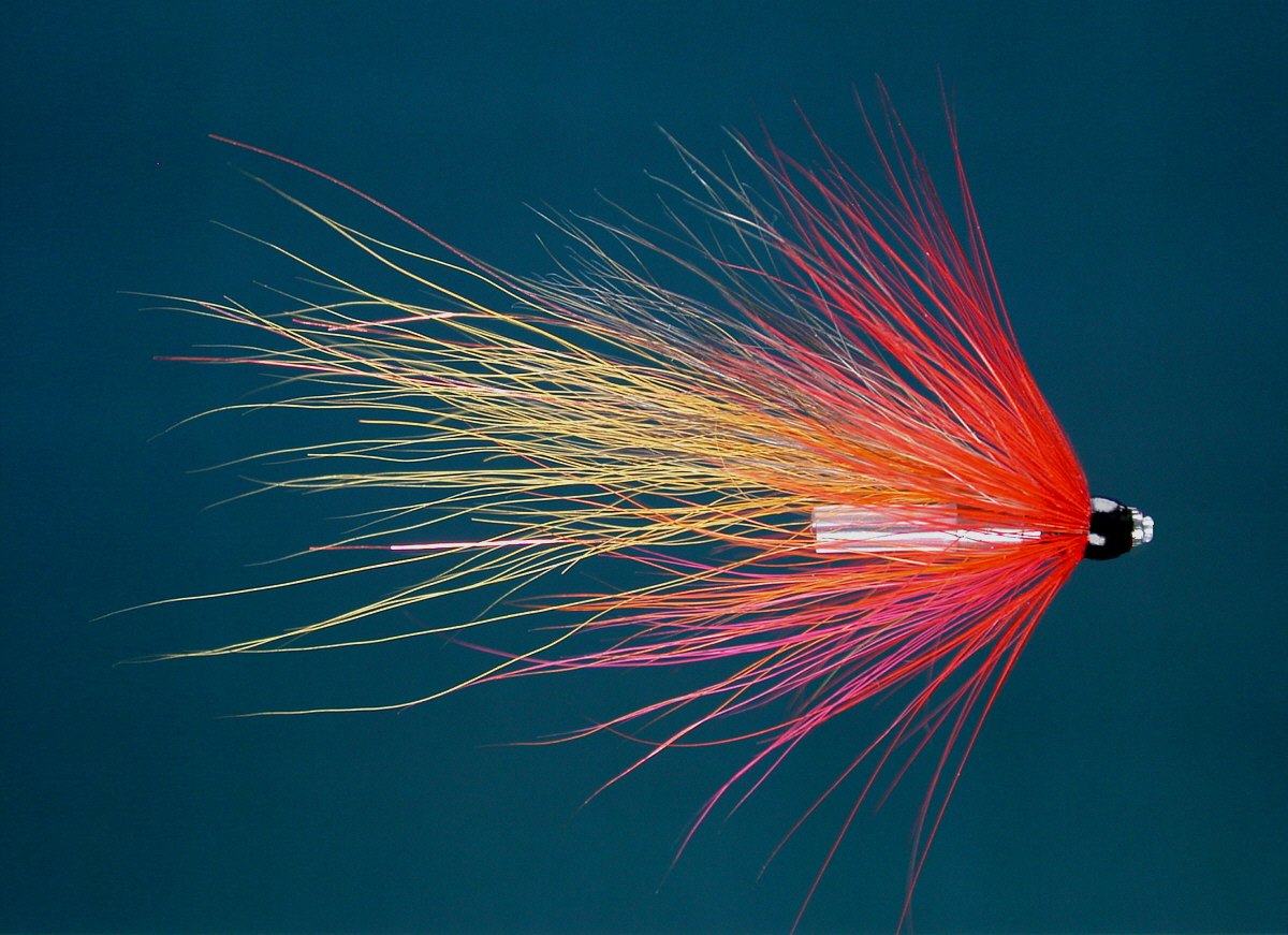
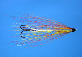
Salmon Flies
Trout Fishing Scotland
Trout- Where to Fish
Trout Fishing Tackle
Trout Fishing Tactics
Trout Flies
Sea Trout Fishing Scotland
Sea Trout - Where to Fish
Sea Trout Tackle
Sea Trout Tactics
Sea Trout Flies
Fishing Maps of Scotland
Fishing Articles
Fly Tying
Fishing Photographs
Book of Flies
Fishing Diary
Where to Stay
Fishing Clubs
Fishing Tackle Shops
Fly Fishing Knots
Fishing Weather
Fishing Books
Salmon Recipes
Flies Online
Links
Sitemap
|
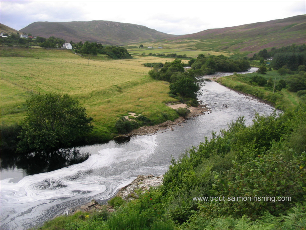
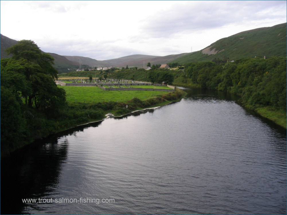
Salmon Fishing - River Helmsdale Scotland
O. S. Map 17
A great salmon river, the most productive in the
north of Scotland. The best of the fishing, however, is strictly
preserved and inaccessible to most. The fishing is divided into
twelve beats, six above the falls of Kildonan and six below, with
one top beat and one bottom beat available to two rods each day,
allowing a total of twelve rods to fish.
Salmon may be caught from the
opening day on January 11th, although the fisherman and his
gillie may have to break the ice before fishing. Salmon will have
passed up through the falls by the beginning of April, giving excellent fishing
through April and May, with grilse running through June, July and into
August. As on all northern rivers, fishing is by fly only
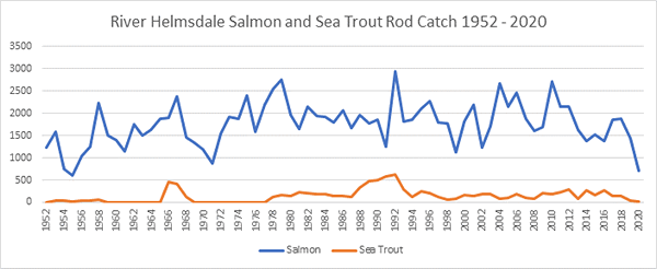
Catch statistics are not widely
publicised but it was once reported that one top beat alone had nearly
600 salmon for the season, with 94 to two rods in a week. Access to the
private beats is strictly limited but the occasional rod may be
available in early season. Day tickets are available for the association
water in the village of Helmsdale, a mile of water which can fish well
throughout the season for salmon, with good sea trout fishing in the
summer months.
|
|
|
River Helmsdale Fishing Map
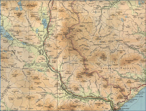
click on map to select an area to enlarge The maps on this website have been
reproduced with the permission of Collins Bartholomew. Please note that these maps may date back several decades.
Much of the human detail will have changed but the character of the rivers and
lochs, and the trout and salmon in them, will be much the same as they have
always been.
In addition to the information provided
here, I would recommend that anyone planning a fishing or
walking trip in Scotland should equip themselves with a compass
and the appropriate Ordnance Survey map. The most useful of the
O.S. maps for the fisherman is the Landranger series, scale
1:50,000. For each of the lochs and rivers listed here, I have given the
relevant O.S. Map number.
See
Ordnance
Survey Maps |