Salmon Fishing - River Halladale Scotland
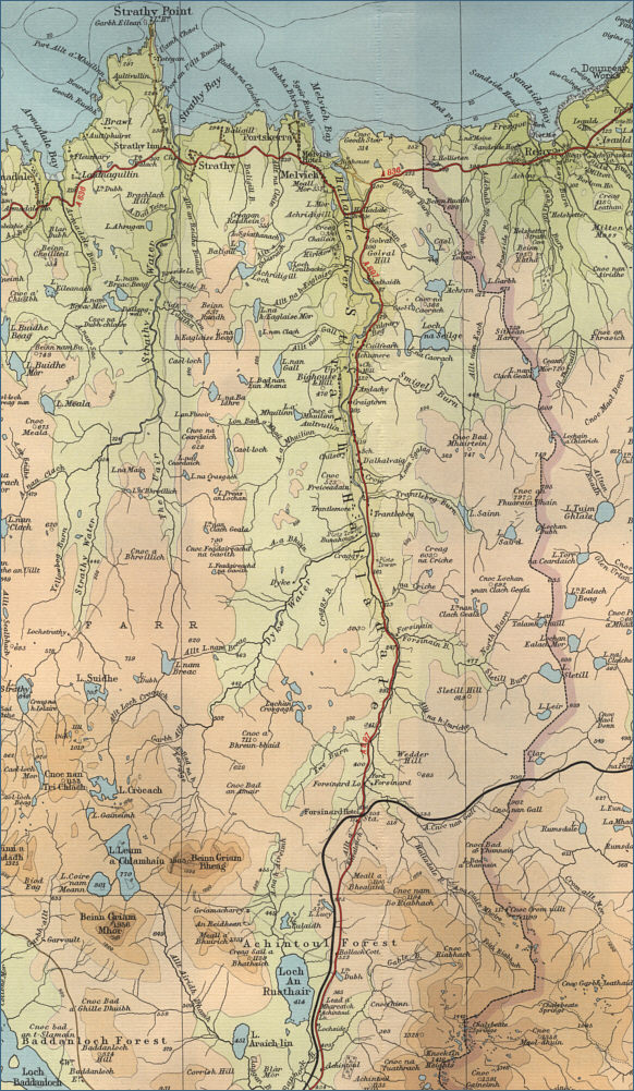
O. S. Map 10
Apart from in its upper course,
in the Forsinard area, the River Halladale is, for most of its
twenty mile length, a rather sluggish salmon river. Nevertheless,
this northern Sutherland river can provide
excellent salmon fly fishing. Very much a spate river, the Halladale
relies very much on rain to give good sport, and the rule, as on
most other northern rivers, is fly only.
The Halladale river rises in the hills to the south
east of Forsinard and flows northwards to enter the sea at Melvich. Salmon can be taken in April but the best months are
from June to September. Overall, the average size of fish is about 7 pounds but,
given rain, there can be a lot of them. The earlier run of Spring fish
average 9 to 10 pounds, while the grilse, which may appear from June
onwards, will be in the 4 to 5 pound range, with some larger summer
salmon running throughout the latter part of the season.
The river is divided into six
beats, the lower four beats, with three rods on each, fished in
rotation. In a normal year the eight miles of the four lower beats would
traditionally produce in the
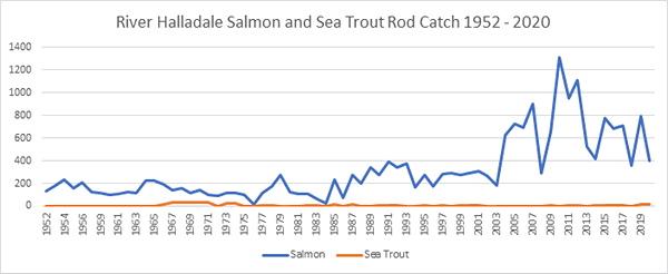
region of 300 fish, while the upper two beats might have 50. Recent
years, however, have seen an improvement in the salmon catch, with the
five year average for the season rising to around 600 fish. The 2006
season produced the best catch of spring salmon on record, with 203
salmon taken before mid June. The fishing is usually let in conjunction
with holiday cottage accommodation.
|