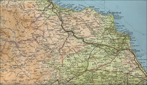
|
| |
|
|
|
Salmon Fishing in Scotland River Whiteadder
|
O.S. Map 67
The River Whiteadder is a major
tributary of the Tweed, flowing out of Whiteadder reservoir before
being joined by tributaries Faseney Water, Bothwell Water, Monynut
Water and Dye Water. Later the Whiteadder is joined by its major
tributary, Blackadder Water. A further five miles sees the
Whiteadder joining the tidal reaches of the Lower Tweed, two and a
half miles upstream of Berwick.
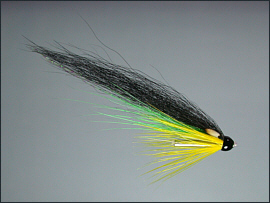
|
|
|
|
|
|
|
Interactive Map of the River Whiteadder
View Google maps and aerial satellite
photographs of the River Whiteadder
You may also search for information about the
area using the map search function
Javascript should be enabled to view
this map map provided by Google
Maps API |
| |
| Change views, e.g. map or
satellite photograph, using the buttons at
the top. |
| Zoom in or out on
map or satellite view using slider on left. |
| Move to
right or left, up or down using the arrows or by clicking and dragging
any point on the map. |
| Search for
information by typing a word or phrase (e.g. "hotel accommodation") into the search box. |
| Return to original
map location by clicking the centre of the circle top left. |
| |
|
| |
Salmon Fishing on the River Whiteadder
The Whitadder has decent runs of salmon
and sea trout, and good brown trout fishing. The autumn months give the
best chance of migratory fish, especially after a good fall of rain.
Enquiries about the fishing should be directed to the Berwick and
District Angling Association.
Angling Clubs and Associations
Berwick and District
Angling Association
Enquiries to Secretary
D Cowan, 129 Etal Road, Tweedmouth, Berwick upon Tweed.
|
| |
|
River Whiteadder - Fishing Map
|
To view a larger scale map of a particular
section of the River Whiteadder, click on a selected area of the map below. |
|
|
click on map to select an area to
enlarge
|
The maps on this website have been
reproduced with the permission of Collins Bartholomew.
Please note that these maps may date back several decades.
Much of the human detail will have changed but the character of the rivers and
lochs, and the trout and salmon in them, will be much the same as they have
always been.
In addition to the information provided
here, I would recommend that anyone planning a fishing or
walking trip in Scotland should equip themselves with a compass
and the appropriate Ordnance Survey map. The most useful of the
O.S. maps for the fisherman is the Landranger series, scale
1:50,000. For each of the lochs and rivers listed here, I have given the
relevant O.S. Map number. See Ordnance
Survey Maps |
|
|
|