Site Contents
Home
Salmon Fishing Scotland
Salmon - Where to Fish
Salmon Fishing Tackle
Salmon Fishing Tactics
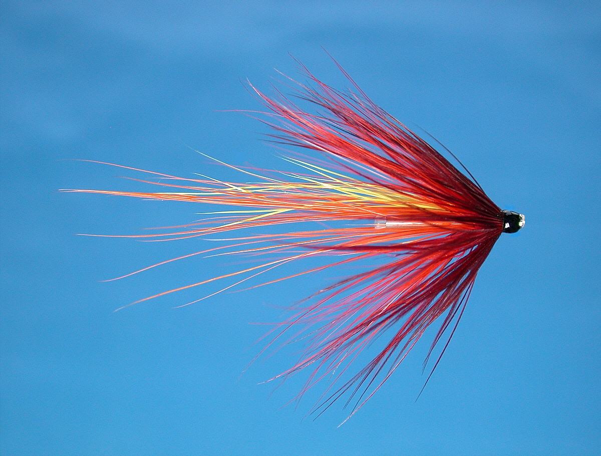
Salmon Flies
Trout Fishing Scotland
Trout- Where to Fish
Trout Fishing Tackle
Trout Fishing Tactics
Trout Flies
Sea Trout Fishing Scotland
Sea Trout - Where to Fish
Sea Trout Tackle
Sea Trout Tactics
Sea Trout Flies
Fishing Maps of Scotland
Fishing Articles
Fly Tying
Fishing Photographs
Book of Flies
Fishing Diary
Where to Stay
Fishing Clubs
Fishing Tackle Shops
Fly Fishing Knots
Fishing Weather
Fishing Books
Salmon Recipes
Flies Online
Links
Sitemap
|
Salmon Fishing - River Tweed
Scotland
O. S. Map 72,
73, 74
The great River Tweed is born at Wells of Tweed,
1500 feet up in the hills north of Moffat and flows eastwards for
100 miles to enter the North Sea at Berwick, picking up on its way
the major tributaries, Yarrow and Ettrick, Gala Water, Leader Water,
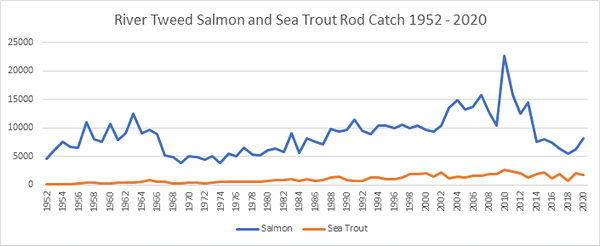
Teviot, Till and Whiteadder. Best known as an autumn salmon river,
the Tweed has regularly produced over 10,000 salmon in recent
seasons, plus substantial numbers of sea trout, some of the sea
trout big fish caught by salmon fishers in the back end months.
Fly fishing is done from both bank and boat, the latter
particularly in the wide reaches of the lower river. There are 128
riparian owners on the Tweed, Some of the best and most famous beats, on
the middle and lower river include Pavillion, Drygrange, Bemersyde,
Dryburgh, Mertoun, Makerstoun, Floors, Junction, Hendersyde, Sprouston,
Carham, Cornhill, Twizzel and Ladykirk. Further upstream, beats include
Lyne, Kailzie, Horseburgh Castle, Cadrona, Traquair, Caberston, Holylee,
Thornielee, Ashiesteel, Peel and Yair. The netting stations which used
to operate on lower Tweed have been bought out. Fresh salmon enter the
river throughout the year right to the close of the season at the end of
November. Prices on the top middle beats at the peak of the season are
beyond most anglers' reach. Some anglers, it seems, are both able and
willing to pay silly money for the privilege of fishing this world
famous river, with some beats fetching in the region of £4000 per rod
per week. Fortunately, good fishing is nevertheless available on the
river at reasonable prices. Fishing can be had on good beats in the less
productive months at reduced rates, and there is some good water in the
upper river, including the town water at Peebles, available to visitors.
Some angling clubs and associations may be able to offer salmon permits
to visiting anglers.
|
|
|
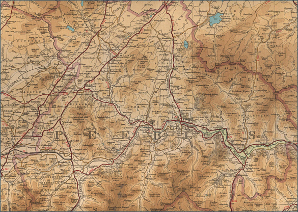
Upper River Tweed - Fishing Map
To
view a larger scale map of a particular section of the River
Tweed, click on a selected area of the maps below.
Middle River Tweed - Fishing Map
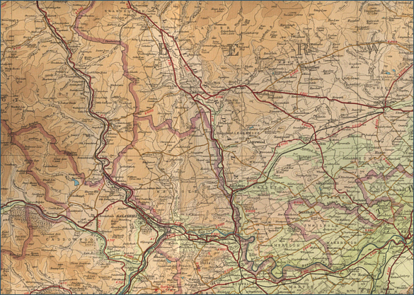
Lower River Tweed - Fishing Map
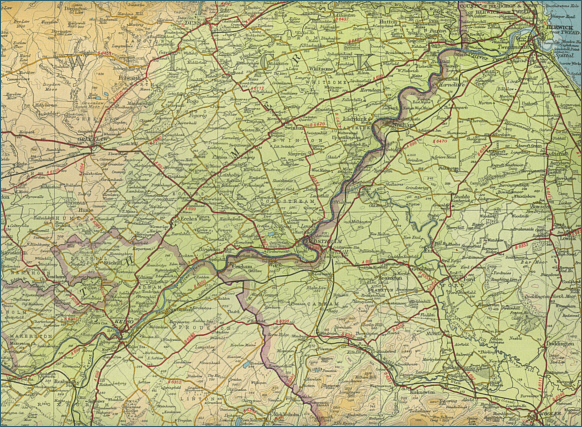
The maps on this website have been
reproduced with the permission of Collins Bartholomew. Please note that these maps may date back several decades.
Much of the human detail will have changed but the character of the rivers and
lochs, and the trout and salmon in them, will be much the same as they have
always been.
In addition to the information provided
here, I would recommend that anyone planning a fishing or
walking trip in Scotland should equip themselves with a compass
and the appropriate Ordnance Survey map. The most useful of the
O.S. maps for the fisherman is the Landranger series, scale
1:50,000. For each of the lochs and rivers listed here, I have given the
relevant O.S. Map number.
See
Ordnance
Survey Maps |