Site Contents
Home
Salmon Fishing Scotland
Salmon - Where to Fish
Salmon Fishing Tackle
Salmon Fishing Tactics
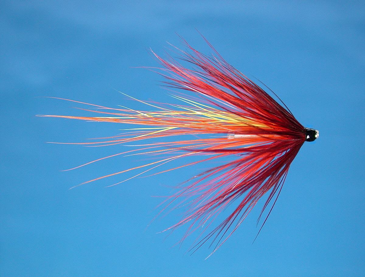
Salmon Flies
Trout Fishing Scotland
Trout- Where to Fish
Trout Fishing Tackle
Trout Fishing Tactics
Trout Flies
Sea Trout Fishing Scotland
Sea Trout - Where to Fish
Sea Trout Tackle
Sea Trout Tactics
Sea Trout Flies
Fishing Maps of Scotland
Fishing Articles
Fly Tying
Fishing Photographs
Book of Flies
Fishing Diary
Where to Stay
Fishing Clubs
Fishing Tackle Shops
Fly Fishing Knots
Fishing Weather
Fishing Books
Salmon Recipes
Flies Online
Links
Sitemap
|
Trout and
Salmon Fishing on the River Clyde, Scotland
O. S. Map 64, 72, 78
The River Clyde
is one of Scotland's great rivers, renowned, in its lower course,
more for shipbuilding than for fishing. The upper river has long
been highly regarded as a trout and grayling stream, with some of
the nicest fly water you could imagine. In addition, salmon and sea
trout fishing is now improving on the lower river.
The River Clyde has some great fishing
for wild brown trout, grayling and, more recently, salmon and sea trout
in the lower part of the river. Virtually the whole river is accessible
to visiting anglers by day or season permit, at very reasonable prices,
from local angling clubs, the most prominent being the United Clyde
Angling Protection Association (UCAPA) and the Lamington and District
Angling Association. The lower river flows through the Glasgow
conurbation and until fairly recently suffered from heavy industrial
pollution. With the demise of much of the heavy industry, the river is
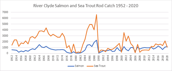
now much cleaner in its lower course, so much so that salmon and sea
trout, absent for two centuries, are now returning in increasing
numbers. Stocks of salmon and sea trout are now at a level where fishing
is worthwhile and salmon and sea trout are being caught regularly on the
lower river. Unfortunately, the migratory fish are restricted to the
lower section of the Clyde below the impassable Falls of Clyde at New
Lanark. Salmon fishing permits for around twelve miles of river are
available from the Secretary, U.C.A.P.A., Civic Centre, Motherwell,
Lanarkshire, Scotland. Trout fishing permits may be purchased from most
fishing tackle shops in the Clyde valley, post offices in Abington,
Crawford and Leadhills and local tourist information offices. Permits
for the Lamington Association water are available from the newsagents in
Biggar.
|
|
|
|
See also
Scottish Salmon and Sea Trout Catches
River Avon
Migratory fish also
have access to the River Avon, the major Clyde tributary which passes
Strathaven, Stonehouse and Larkhall on its way to join the Clyde at
Hamilton. Salmon and sea trout fishing is improving throughout the
length of the Avon, where the Avon Angling Club has approximately 14
miles of fishing, offering excellent brown trout and grayling fly
fishing with improving runs of salmon and sea trout. Annual membership
of Avon A.C. available at reasonable rates. Enquiries should be directed
to fishing tackle shops in the area. |
Angling Clubs and Associations
United Clyde Angling Protection Association
Secretary,
c/o Civic Square Post Office,
39 Civic Square, Motherwell, Lanarkshire ML1 1TP
Lamington and District Angling Association
Enquire H Bryden, newsagents,
High Street, Biggar
Avon Angling Club
Hozier Angling Club
|
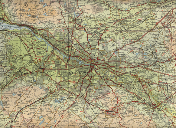
Lower River Clyde - Fishing Map
To
view a larger scale map of a particular section of the River
Clyde click on a selected area of the maps below.
Middle River Clyde
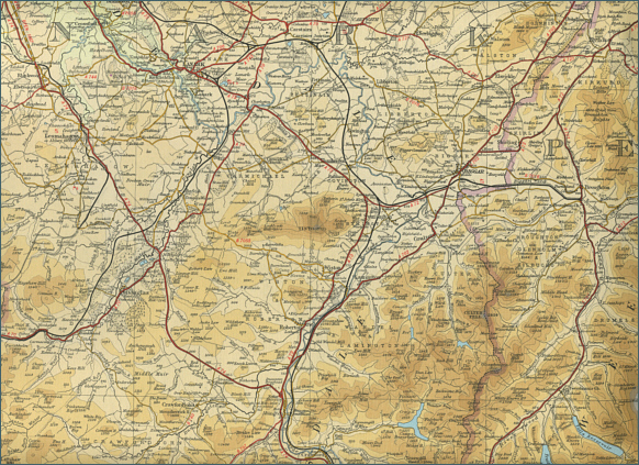
Upper River Clyde
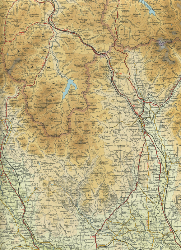 |
The maps on this website have been
reproduced with the permission of Collins Bartholomew. Please note that these maps may date back several decades.
Much of the human detail will have changed but the character of the rivers and
lochs, and the trout and salmon in them, will be much the same as they have
always been.
In addition to the information provided
here, I would recommend that anyone planning a fishing or
walking trip in Scotland should equip themselves with a compass
and the appropriate Ordnance Survey map. The most useful of the
O.S. maps for the fisherman is the Landranger series, scale
1:50,000. For each of the lochs and rivers listed here, I have given the
relevant O.S. Map number.
See
Ordnance
Survey Maps |