Site Contents
Home
Salmon Fishing Scotland
Salmon - Where to Fish
Salmon Fishing Tackle
Salmon Fishing Tactics
Salmon Flies
Trout Fishing Scotland
Trout- Where to Fish
Trout Fishing Tackle
Trout Fishing Tactics
Trout Flies
Sea Trout Fishing Scotland
Sea Trout - Where to Fish
Sea Trout Tackle
Sea Trout Tactics
Sea Trout Flies
Fishing Maps of Scotland
Fishing Articles
Fly Tying
Fishing Photographs
Book of Flies
Fishing Diary
Where to Stay
Fishing Clubs
Fishing Tackle Shops
Fly Fishing Knots
Fishing Weather
Fishing Books
Salmon Recipes
Flies Online
Links
Sitemap
|
Salmon Fishing River Ayr Scotland
O. S. Map 70
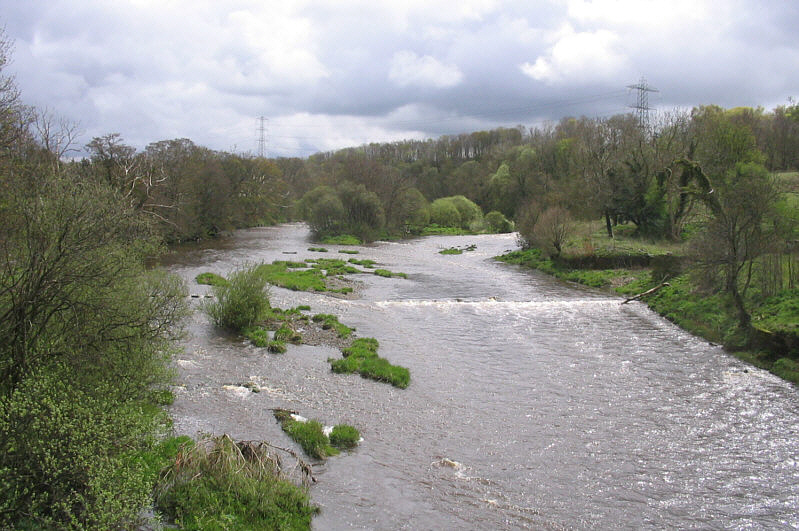
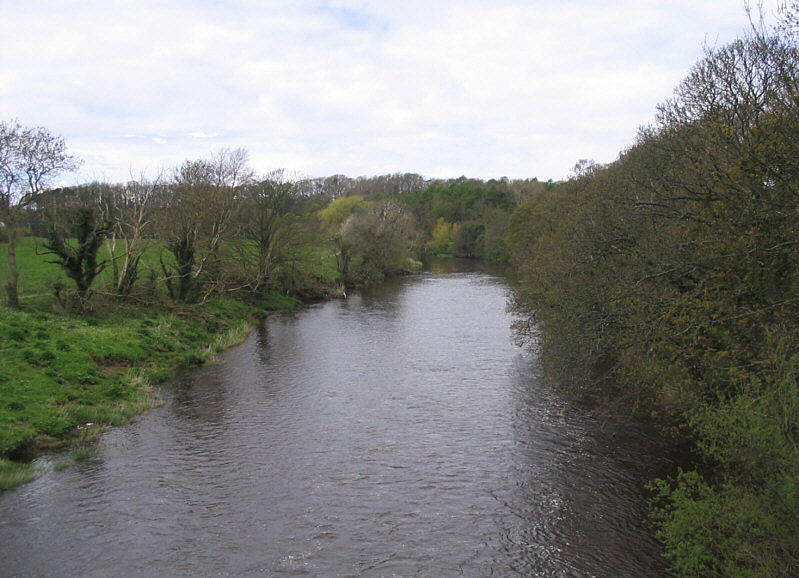
The Ayr is the
largest of the Ayrshire rivers running from its source near New
Cumnock the thirty nine miles to Ayr. The Ayr is a spate river but
drawing water from a larger catchment area than neighbouring rivers.
Spates, therefore, tend to last a bit longer, falling off in days
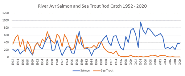
rather than hours. In a good season 500 salmon might be taken and a
few sea trout.
The main runs of
salmon on the River Ayr begin with the first July spates and continue
through to October, given the all important rain. A good proportion of
the salmon are taken on bait or spinner but there are also some nice
stretches of fly water. Visitors may fish most of the river, including
the Ayr Town water and the water controlled by local angling
associations. Most of the river is, in fact, controlled by local angling
clubs, which offer permits via Gamesport Tackle Shop in Ayr's Sandgate.
Angling Clubs and Associations
Auchinleck Angling Association
G McClue, 61 Coal
Road, Auchinleck, Ayrshire.
Mauchline & Ballochmyle Angling Club
Secretary: Max Stobbs (07916346774)
Day Permits £15 available from:
|
Gamesport
Sandgate
Ayr
KA7
1BX |
P & R Torbet
Strand Street
Kilmarnock
KA1 1HU |
|
|
|
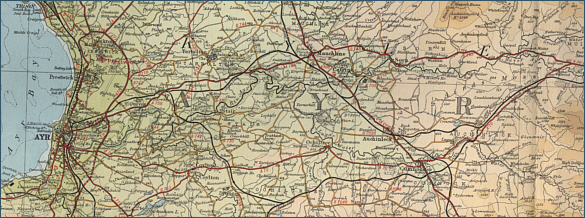
River Ayr - Fishing Map
To
view a larger scale map of a particular section of the River
Ayr click on a selected area of the maps below.
The maps on this website have been
reproduced with the permission of Collins Bartholomew. Please note that these maps may date back several decades.
Much of the human detail will have changed but the character of the rivers and
lochs, and the trout and salmon in them, will be much the same as they have
always been.
In addition to the information provided
here, I would recommend that anyone planning a fishing or
walking trip in Scotland should equip themselves with a compass
and the appropriate Ordnance Survey map. The most useful of the
O.S. maps for the fisherman is the Landranger series, scale
1:50,000. For each of the lochs and rivers listed here, I have given the
relevant O.S. Map number.
See
Ordnance
Survey Maps |