Site Contents
Home
Salmon Fishing Scotland
Salmon - Where to Fish
Salmon Fishing Tackle
Salmon Fishing Tactics
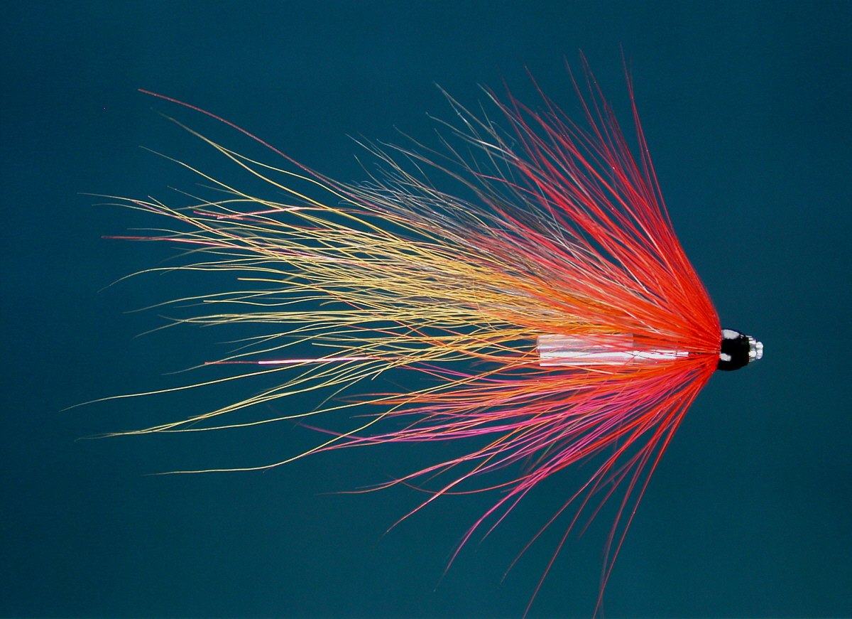
Salmon Flies
Trout Fishing Scotland
Trout- Where to Fish
Trout Fishing Tackle
Trout Fishing Tactics
Trout Flies
Sea Trout Fishing Scotland
Sea Trout - Where to Fish
Sea Trout Tackle
Sea Trout Tactics
Sea Trout Flies
Fishing Maps of Scotland
Fishing Articles
Fly Tying
Fishing Photographs
Book of Flies
Fishing Diary
Where to Stay
Fishing Clubs
Fishing Tackle Shops
Fly Fishing Knots
Fishing Weather
Fishing Books
Salmon Recipes
Flies Online
Links
Sitemap
|
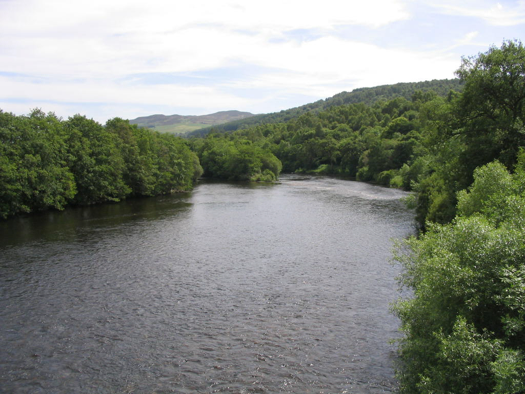
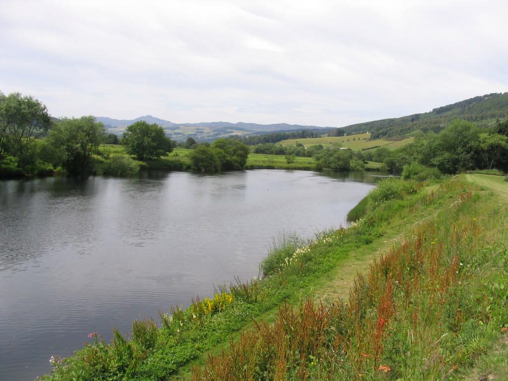
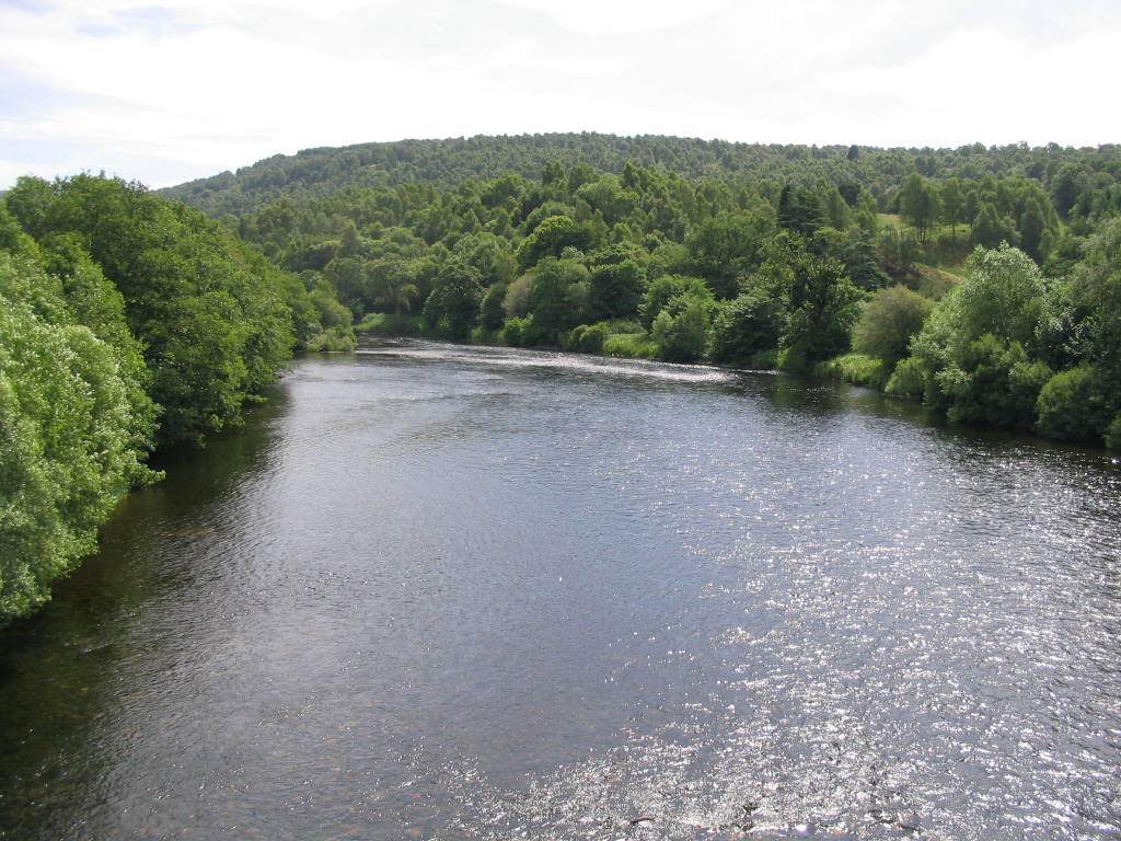
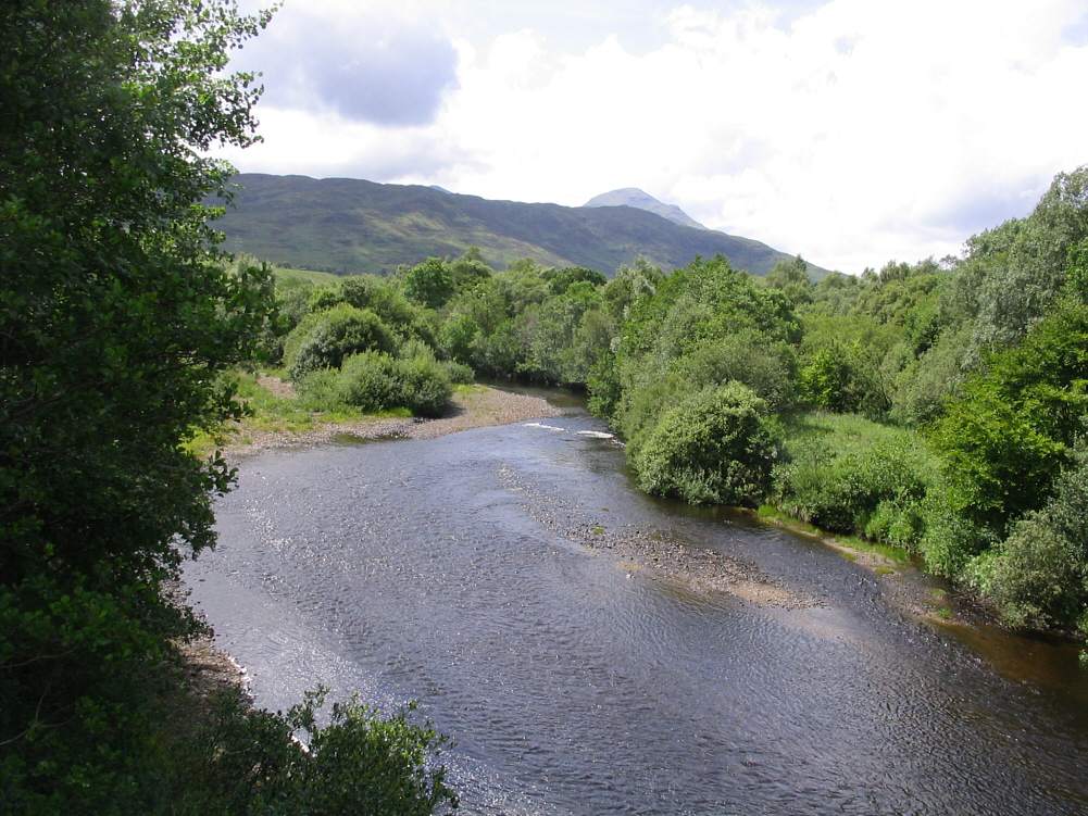
Salmon Fishing - River Tay
Scotland
O. S. Map 53
The largest of
Scotland's salmon rivers, the Tay drains an area of about 2500
square miles and is approximately 120 miles long. It is a big river,
particularly in its middle and lower course below its confluence
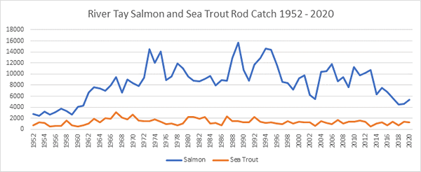
with the River Tummel. The Tay fishing is not what it once was but
can still produce somewhere in the region of 10,000 salmon in a
season.
Much of the fishing,
on the middle and lower beats in particular, is done with the spinning
rod. An alternative to spinning is harling, a method involving the use
of a boat to swing large flies on sinking lines across the wide Tay
pools. Some of the lower pools might be covered, in lower water in
summer and autumn, by a competent fly fisherman wading deep and
speycasting a long line on a seventeen foot rod. The upper river, above
Ballinluig, is naturally smaller and more suited to the fly rod and
might be covered effectively with a fifteen footer. Traditionally The
Tay spring salmon run was renowned wordwide, for numbers and size of
fish. Loch Tay fished well from January to March, as did the upper
river, which also fished well in the autumn months of September and
October. The middle river produced fish from January to March and again
in September and October, while the lower Tay produced spring fish from
January to May and again at the back end. Sadly, the spring fishing
throughout the system is a shadow of its former self and by far the bulk
of the salmon are taken at the back end of the year, with August to
October the best months. In recent years the netting operations on the
river have been bought out and there are hopes that the Tay fishing,
particularly the spring fishing, will improve after many years of
decline.
|
|
|
Angling Clubs and Associations
Taymouth Angling Club
The River Tay from Kenmore Bridge to Logierait
Contact : Mark Bowler, 3 Aberfeldy Road, Kenmore,
Perthshire. PH15 2BL. Tel. 01887 830526
Aberfeldy Angling Club
Secretary : Robert M. Stewart. 18 Rannoch Road, Aberfeldy,
Perthshire. PH15 2BU. Tel. 01887 829512
Dunkeld & Birnam Angling Club
Secretary : Fiona Robertson, 1a Oak Place, Perth Road,
Birnam. PH8 0BH. Tel No. 01350 727656
Stanley & District Angling Club
Secretary :C. Miller, 28 Western Road, Luncarty, Perthshire.
PH1 3HH. Tel 01738 828826
Stormont Angling Club
Secretary : David Brown, 68 Gellyburn Road, Almondbank, PH1
3 HT. Tel 01738 583267 or
Estate Office, Scone Palace, Perth, Perthshire. PH2 6BD.
Estate Office Tel. 01738 552308
Perth & District Anglers Association
Secretary : Peter Backhouse, 9 The Guest House, Pitcullen
Road, Perth. PH2 7NG
|
River Tay - Fishing Maps
To view a larger scale map of a particular
section of the River Tay, click on a selected area of the maps below.
Upper River Tay Fishing Map
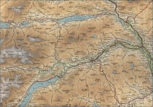
Middle River Tay Fishing Map
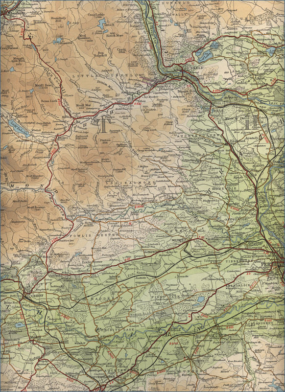
Lower River Tay Fishing Map
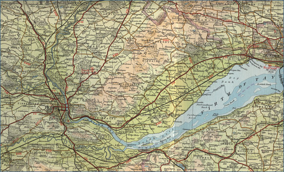
The maps on this website have been
reproduced with the permission of Collins Bartholomew. Please note that these maps may date back several decades.
Much of the human detail will have changed but the character of the rivers and
lochs, and the trout and salmon in them, will be much the same as they have
always been.
In addition to the information provided
here, I would recommend that anyone planning a fishing or
walking trip in Scotland should equip themselves with a compass
and the appropriate Ordnance Survey map. The most useful of the
O.S. maps for the fisherman is the Landranger series, scale
1:50,000. For each of the lochs and rivers listed here, I have given the
relevant O.S. Map number.
See
Ordnance
Survey Maps |