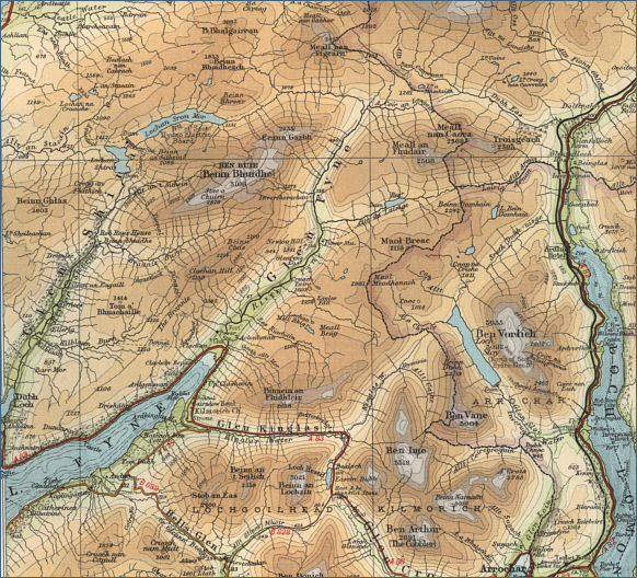
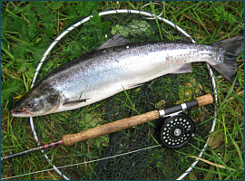
|
| |
|
|
|
Salmon Fishing in Scotland River Fyne
|
O.S. Map 50
The river Fyne
at one time, as recently as 1989, produced in the region of 250
salmon in a season, despite the severe impoundment of its waters for
the production of Hydro Electric power. Sadly, recent years have
seen a dramatic decline in stocks of migratory fish on the river.
|
|
|
|
|
|
|
Interactive Map of the River Fyne
View Google maps and aerial satellite
photographs of the River Fyne
You may also search for information about the
area using the map search function
Javascript should be enabled to view
this map map provided by Google
Maps API |
| |
| Change views, e.g. map or
satellite photograph, using the buttons at
the top. |
| Zoom in or out on
map or satellite view using slider on left. |
| Move to
right or left, up or down using the arrows or by clicking and dragging
any point on the map. |
| Search for
information by typing a word or phrase (e.g. "hotel accommodation") into the search box. |
| Return to original
map location by clicking the centre of the circle top left. |
| |
|
| |
Salmon Fishing on the River Fyne
In recent seasons,
the runs of salmon into the River Fyne have been depleted to such an
extent that the river has been closed to fishing. Many fishermen blame
the presence of fish farms in Loch Fyne for the dramatic collapse in
fish stocks.
For further information, contact the Head Keeper,
Ardkinglass Estate, Cairndow, Argyll.
|
| |
|
River Fyne - Fishing Map
|
To view a larger scale map of a particular
section of the River Fyne, click on a selected area of the map below. |
|
|
click on map to select an area to
enlarge
|
The
maps on this website have been reproduced
with the permission of Collins
Bartholomew.
Please
note that these maps may date back several
decades. Much of the human detail will have
changed but the character of the rivers and
lochs, and the trout and salmon in them,
will be much the same as they have always
been.
In
addition to the information provided here, I
would recommend that anyone planning a
fishing or walking trip in Scotland should
equip themselves with a compass and the
appropriate Ordnance Survey map. The most
useful of the O.S. maps for the fisherman is
the Landranger series, scale 1:50,000. For
each of the lochs and rivers listed here, I
have given the relevant O.S. Map number. See
Ordnance Survey Maps |
|
|
|