Salmon Fishing - River Lossie Scotland
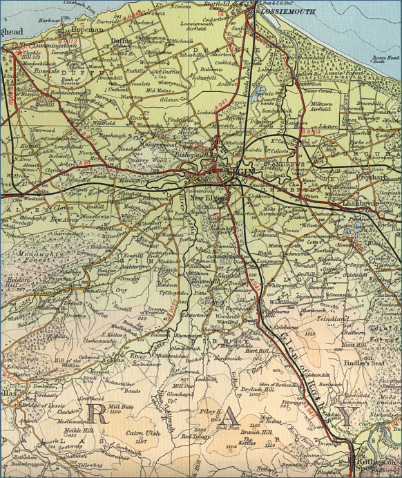
O. S. Map 28
The River Lossie flows northwards through Morayshire
to Elgin, entering the Moray Firth a few miles further on at Lossiemouth. Although overshadowed by its illustrious
neighbours, the Spey and Findhorn, the River Lossie can, in suitable
conditions, provide some excellent salmon and sea trout fishing,
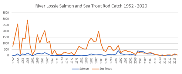
with something in the region of 100 salmon caught in
a season and up to 400 sea trout.
The Lossie is a small spate river,
sluggish in parts and overgrown in places. Some parts are suited to fly
fishing, a single handed rod being adequate. A number of sea trout are
taken in the tidal section of the river at Lossiemouth, mainly by
spinning. The
lower 10 miles of the river are controlled by the Elgin & District
Angling Association. Permits are readily available from the Tackle shop
in Elgin.
Angling Clubs and Associations
Elgin & District Angling Association - Enquirie
The Tackle Shop, 188 High Street, Elgin.
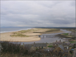
Lossiemouth
|