Sea Trout Fishing on River Tyne
Scotland
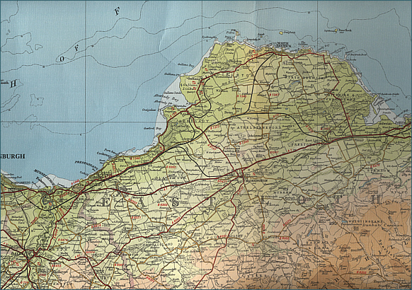
O. S. Map 67
The East
Lothian Tyne is a small spate river, passing through Haddington and
entering the Firth of Forth just north of Dunbar. The river is
principally a brown trout river but with improving runs of migratory
fish, in particular sea trout.
Angling Clubs and Associations
East Lothian Angling Association
The fishing on
the river Tyne is managed by the progressive East Lothian Angling
Association, which issues day and season tickets at very reasonable
rates. Permits are available from a wide variety of outlets locally.
For more
information, see the
ELAA website.

flies by
Grays of Kilsyth |